Categories
charitable Coast to Coast Weekend

Possibly my last word on the Coast to Coast walk

Coast to coast wrapup

We finished the Coast to coast walk 5 days ago. My feet are starting to recover and I am now away on a business trip for a couple of weeks – Brussels, Barcelona and Copenhagen. It’s the way to roll.

In packing for the trip I put away some of my winter wardrobe – thick pullovers etc – and retrieved some of my summer stuff –  loud but tasteful Hawaiian shirts – you know me. Whilst I didn’t lose any weight on the walk due to the high intake of compensatory calories I’ve found that my shirts are a more comfortable fit and I am almost comfortable with the next notch in on the belt. All good stuff.

I have had time to reflect on the two weeks on the trail. How do I feel having finished? I feel good about it. Sometimes I glow. 190 miles from coast to coast. Wow. 🙂 Would I do it again. Not a hope in hell.

I caveat that last remark. I would consider such a challenge but it would have to have better planning. We took on too much on a daily basis. Shorter distances giving us time to enjoy ourselves should be the order of the day. This can be a problem for people with limited holidays. Two weeks is usually the maximum sensible time off work. Every additional night also adds to the cost. It comes as no surprise that the people we met taking the easier, longer option were retired gentlefolk (I just added that gentlefolk bit in for effect).

There would also have to be a solution to my sore feet. This could be an experimentation with different insoles, anti bruising agents such as Arnica cream and Voltarol gel for the reduction of pain.

I have noticed since finishing and since the tiredness has worn off (I was completely knackered for a couple of days afterwards) that I am now quite relaxed. This must be the byproduct of lots of exercise, being extremely focussed on the task in hand,  not thinking about work and the absence of TV, internet and telephony from my life. OK I did have some connectivity but this was sporadic and limited. Possibly a lesson there.

I am also happy with the cash we raised for Cancer research UK. It could always have been a lot more but actually considering it was mostly done through Facebook and with very little proactive effort once the walk had started it’s a goodly sum. Remember I was doing it in memory of my Mam who died a year ago to the day we started walking. She was in my mind as I walked along and I think it appropriate that I smile as I now think of her.

Having completed the challenge I now feel up to taking on others. Not this year but I will be giving it some thought. Ideas are welcomed.

I guess I will finish by thanking everyone who supported us on the walk and especially to my gorgeous wife Anne who has to put up with a lot and who came to meet us on her birthday. She was greeted by a husband writhing in agony on the bed because of his sore feet and treated to a sit down fish and chip supper in the Shap Chippy. Very salubrious but it did the job.

To those of you who have been kind and generous enough to donate cash to Cancer Research UK I will be in touch with you individually whenever i can fit it in over the coming fortnight. I am away on business until a week on Friday.

Worralife eh? 🙂

Oh and one final word on A Wainwright, the designer of the coast to coast walk, national treasure, icon to walkers everywhere and a complete and utter b&^%$£d swine for being the architect of my suffering over two extremely tough weeks that I can now look back on and smile.

PS look out for the movie – remember I have 36GB of pics and vids to sort…
Categories
charitable Coast to Coast Weekend

Coast to Coast walk gadget review

Coast to Coast walk gadget review

Coast to Coast walk gadget review includes Samsung Galaxy S7 Edge, Runkeeper, OS Maps online, Fitbit, Pangea Tracker and the Leatherman multitool.  I carried with me a number of gadgets and used 2 main Apps on the coast to coast walk. Here’s what I thought of them.

Samsung Galaxy S7 Edge

The Edge was bought several weeks prior to the coast to coast walk as my Oneplus2 had failed miserably in the rain during the Llanberis training week. In fact it died on me. The edge claims to be waterproof and can withstand being under 5 feet of water for up to 30 minutes.

I tried it out in the rain before going o the walk and had no problems. The camera is brilliant and the phone feels great to hold.

Under true field conditions the problems showed themselves. Firstly the rain was so heavy that every time a raindrop hit the screen the phone thought I was pressing a button. It went haywire. This was particularly inconvenient when I needed to use the GPS.

At our lunch stop under a soaking wet railway bridge I dropped the phone and subsequently found I’d cracked the back. At least the screen survived for me to be able to use it on the rest of the walk.

The phone was kept in my waterproof coat pocket. This pocket filled with water because I left the zip open to access phone/gloves/stuff. This didn’t particularly seem to affect the phone but the battery did run out during the afternoon and my external charger wouldn’t work because the phone detected “moisture in the USB port”. The next day I left the phone in a dry bag in the rucksack and used my GoPro in it’s waterproof case.

The GoPro worked fine but needed the images and videos manually backing up which was a faff.

After day two the weather was near perfect so I reverted to the use of the phone which I kept wrapped in my merino buff, really just to prevent condensation (from my profusely sweating body) getting to the screen and affecting its responsiveness to my finger. I needed fast responsiveness to be able to quickly take pics.

At around the middle of the afternoon I’d retrieve the external charger from the dry bag and plug it into the phone. One charger with 7800mAh was enough but not over the top. After a couple of days I left the second spare power pack in my main bag that was transported between B&Bs.

Apart from the camera, which with 36GB of pics and vids taken was the most used app, the most useful app was Runkeeper. Runkeeper told us how many miles we had come and therefore how many we had yet to go. It also told us how long we had taken and the miles per hour walking rate. This was all important info especially as we needed to try and keep up the pace over the long days and distances. My overall pace was hampered by heel blisters that slowed Tom and I down over the 12 days.

I was also able to broadcast our progress live using Runkeeper. Once the activity had been started, son Joe at Newcastle University would log in, take the link and insert it in the day’s pre-written blog post. Images and videos, uploaded in real time where there was connectivity, would also be transferred into the pre-created album of the day.

Connectivity was very poor along most of the route. Bear in mind Wainwright (forever labeled Wainwright the sadist in my mind) took you away from roads and up steep sided mountains wherever possible. The Lake District connectivity was especially poor, both mobile and fixed. In the interest of survival and resting my knee, hammered on the day 2 descent from Honister, Tom and I sometimes took an alternative route by road, avoiding rocky descents.

Poor connectivity didn’t stop the Runkeeper tracking from working. It would just wait for some bandwidth availability before updating the online database.

The other great app I used was the Ordnance Survey online mapping tool. Before the trip I created the exact replica of Wainwright’s route for each day using the tool. This was then downloaded onto the phone for offline use. Essential for a route with little connectivity. The absence of mobile data connectivity didn’t stop the GPS from working. Whilst we mostly used a paper map we did find it very convenient to resort to the Ordnance Survey which would then tell us whether we were off course or not. This saved us time and effort on quite a number of occasions and I very much recommend it if you are into the outdoor recreation game. I wouldn’t rely on the OS Maps app as the main navigation tool. It feels like it uses a lot of battery power although I have no data to back this up. Also in the rain it is safer to use a map securely stored in a waterproof map case or even a waterproof map.

I had with me a Fitbit Surge watch. Tests had determined that whilst this did work as a tracker the battery life was not sufficient when using GPS. The latest we got in was 8.15 pm on the second day. The phone battery could be supplemented by the external charger but this was not possible with the Fitbit as the socket was underneath the display, ie resting on your wrist.

The Fitbit would be great for the intended usage – running, working out etc where the times involved might be in the lowe hours rather than days.

I carried with me at all times the Pangea Tracker. This gave me a reliable backup for Runkeeper and also a portal that will allow me to access the whole route when back at base and with some time to properly write up the whole walk (whenever that might be!).

Other gadgets worth mentioning include the Leatherman multitool. I only used it once and that was in the evening at the B&B. Whilst being a really cool boys toy it didn’t take me long to decide that less weight was better than invisible coolness and this was soon relegated to the duffel bag and the transporting van.

The duffel bag btw was a North Face Basecamp XL. Fantastic bags. Really robust. As well as my clothes it also carried my Osprey laptop bag. I used one of my Chromebooks during the evenings, exhaustion permitting, to update the day’s blog. The chromebooks are so cheap as to be almost disposable and taking it along was an acceptable risk.

I think that’s it on the coast to coast walk gadget front. I used the premium, paid for versions of Runkeeper and the OS maps.

The coast to coast walk has been a major feature in my life for the last few weeks. Check out all the posts in the coast to coast category on this blog.

Categories
charitable Coast to Coast Weekend

Coast to Coast walk Day 12 – the finishing line

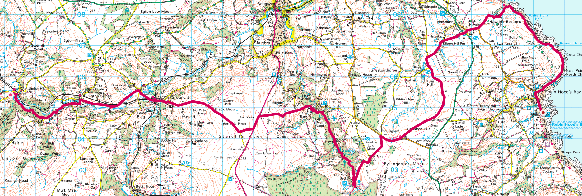
Coast to Coast walk Day 12 – Glaisdale to Robin Hood’s Bay

Follow the final day here.

Coast to coast walk Day 12 is apparently one of real mixed emotions. We will be excited to have completed our challenge but also disappointed that the walk is over. This was succinctly put by Alfred Wainwright when he compared the coast to coast walk with the Pennine Way. “I finished the Pennine Way with relief, the Coast to coast with regret” .

The last day is not a short one. We pass through Grosmont and its steam railway – I once saw the Sir Nigel Gresley A4 Pacific in the station there and have the steepest climb of the walk to get out of the village. A killer it would appear. After that we have a long day headed towards the coast. Our wives are coming to meet us at some point along this route. It will be great to see them 🙂

I am also looking forwards to the celebrations in Robin Hood’s Bay although whether any of us will be in a fit state to do anything is another issue.

Update

Wearily took our time to stroll down into RHB after a footsore (again) day. Called into Grosmont to see the steam trains and had a can of pop and a kit kat. Then the worst climb of the trip – 1 in 3 out of town. Was pleased to say I did it without stopping. Just took it easy.

Fantastic welcoming committee at the pub in RHB. Anne, Sue and Anna Agius and Stu and Jezzer. Very emotional now we’ve finished.

Tom has cramp in his leg – just picked it up on the way down into RHB. In consequence we are going to eat in the Victoria Hotel opposite the B&B to save the walk down into the village again. This does give us the problem of how to communicate this with the Canadians and the Dutch who I said we’d meet at the Wainwright Bar. Will see what I can do to message them. I have Paul’s email address.

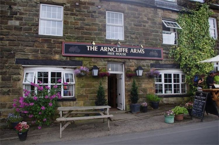
starting B&B The Arncliffe Arms, 1 Glaisedale Terrace, Glaisdale, YO21 2QL
forecast/actual km  29.55/2149 – cut off the hedland in the interest of time
forecast/actual time  9h 09min/8h 15min
weather  cloudy with sunny spells – hazy so couldn’t see the sea
Elevation up/down m  747/578
breakfast  fry up at Arndale Arms – pretty average
lunch  cheese & pickle sandwich, cheese and onion crisps, mars bar and an orange
dinner
finishing B&B Raven House, Victoria Terrace RHB YO22 4RJaLink to Coast to Coast walk Day 12 Photo Album.

Link to Coast to Coast walk Day 12 Photo Album. Photos will upload as soon as there is connectivity and I will move them into the shared album each evening when I get to the pub for dinner or if there is a decent connection, periodically as we go along.

While I am walking I will be using Runkeeper to live track my progress. You can find the link for each day’s progress at my twitter page or at my Facebook profile page. I will also be pinning photos within Runkeeper as I progress. I am also using a Fitbit Surge to provide me with additional monitoring data.

Don’t forget I’m raising cash for Cancer Research UK whilst on this Coast to Coast walkJustGiving page here. The start date of the walk coincides with the anniversary of my mother’s death on May 1st last year. Mam was Chairman of the Marown & District branch of the IoM Anti Cancer Association.

Forecast numbers are based on Ordnance Survey mapped route. I add 1 hour for each approx 500m climb plus an hour for lunch.

A lot of people have helped me in the preparation for this walk. Firstly Mat Kiddie of Amigo who I met on a plane coming back from Mobile World Congress and who sent me a mobile battery charger. Then there is Aideen O’Colmain of Fitbit who very generously donated a Surge. Finally there is Dan Cunliffe and his team at Pangea who provided me with a mobile tracking device that allows me to track my progress independently of having to use my phone.

Categories
charitable Coast to Coast Weekend

Coast to Coast walk Day 11 – we are staying at the Arncliffe Arms

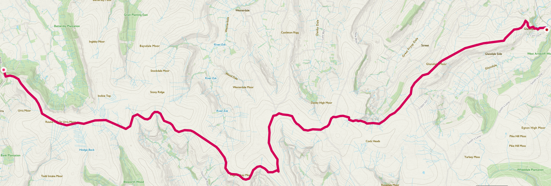
Coast to Coast walk Day 11 – Clay Bank Top to Glaisdale

Track today’s walk live.

Day 11 of our Coast to Coast walk is another long one with the added attraction of the Lion Inn en route for a spot of lunch. We are also staying at another pub, the Arncliffe Arms.

I quite like the idea of arriving at our destination then rolling downstairs for food and drink.

Update

Got dropped off at the Clay Bank Top car park just after 8. Only just made it through the road works before they closed the road. The Dutch, Leo and Sandra, and Canadians, Paul and Lori, were setting off at the same time. The walk starts with a steep climb here and we were soon outpaced by the pros.

At the top we saw a grouse, the first of many. Poor buggers being lined up for sport.

It was a long and dreary walk. The moors are pretty featureless. We made the Lion Inn at noon and the Agius’ followed at 12.25 – despite only having started at 10.15.They are faster walkers.

We had an hour’s break for lunch and headed out again. Still a long way to go. Made it to the Arncliffe Arms at 5.30ish. An hour later than the others. The accommodation isn’t up to much.

starting B&B West Cote, Chop Gate TS9 7JF
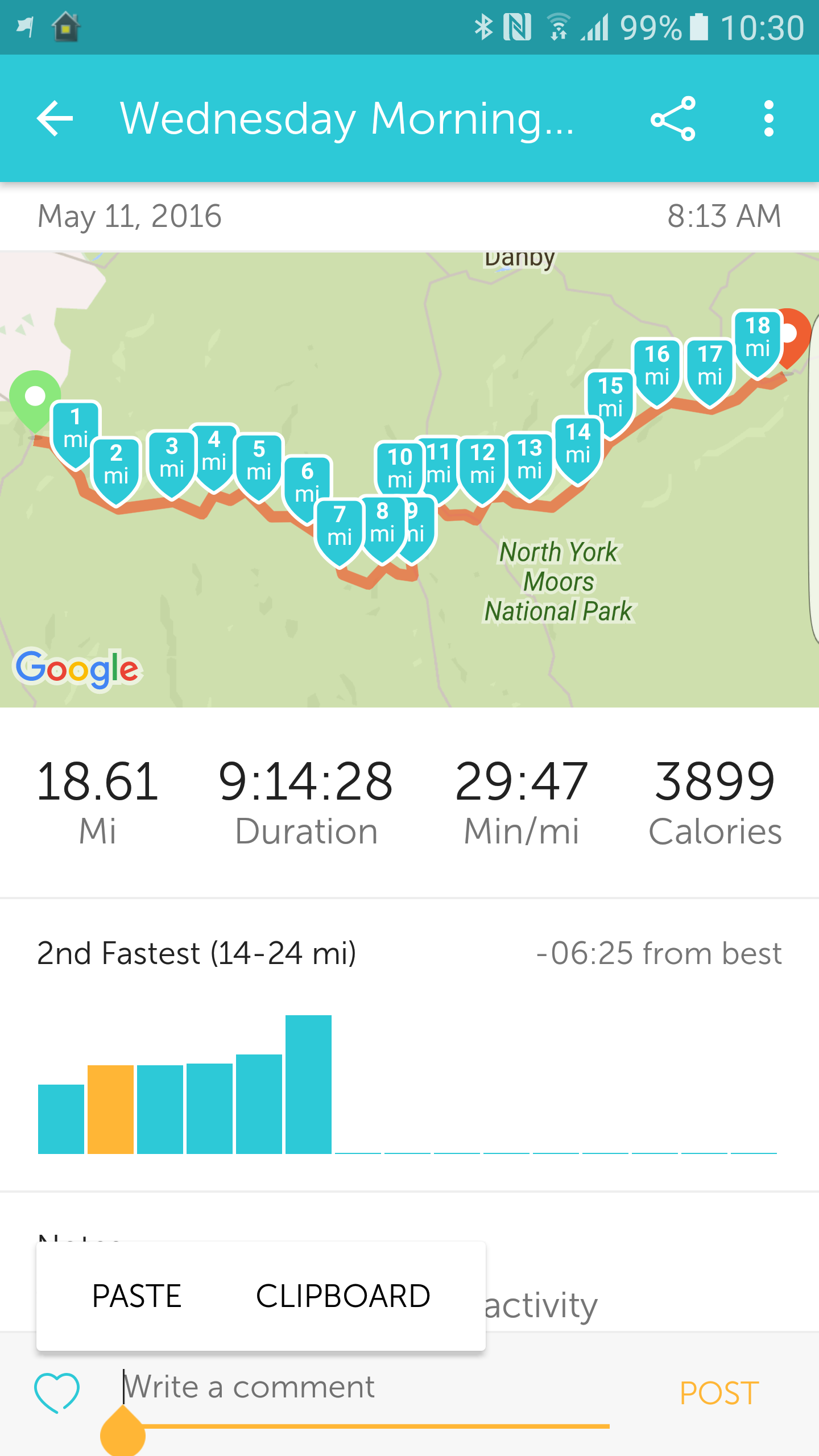
forecast/actual km  29.47/29.78
forecast/actual time  8h 36min/9h 14min
weather  sunny but hazy so couldn’t see the sea from the moors
forecast/actual ascent m  424.6/525
breakfast  Dorset muesli & regional cheese board with toast
lunch  hot beef roll and chips at the Lion Inn
dinner  garlic mushrooms and lasagna
finishing B&B The Arncliffe Arms, 1 Glaisedale Terrace, Glaisdale, YO21 2QL

Link to Coast to Coast walk Day 11 Photo Album Photos will upload as soon as there is connectivity and I will move them into the shared album each evening when I get to the pub for dinner or if there is a decent connection, periodically as we go along.

While I am walking I will be using Runkeeper to live track my progress. You can find the link for each day’s progress at my twitter page or at my Facebook profile page. I will also be pinning photos within Runkeeper as I progress. I am also using a Fitbit Surge to provide me with additional monitoring data.

Don’t forget I’m raising cash for Cancer Research UK whilst on this Coast to Coast walkJustGiving page here. The start date of the walk coincides with the anniversary of my mother’s death on May 1st last year. Mam was Chairman of the Marown & District branch of the IoM Anti Cancer Association.

Forecast numbers are based on Ordnance Survey mapped route. I add 1 hour for each approx 500m climb plus an hour for lunch.

A lot of people have helped me in the preparation for this walk. Firstly Mat Kiddie of Amigo who I met on a plane coming back from Mobile World Congress and who sent me a mobile battery charger. Then there is Aideen O’Colmain of Fitbit who very generously donated a Surge. Finally there is Dan Cunliffe and his team at Pangea who provided me with a mobile tracking device that allows me to track my progress independently of having to use my phone.

Categories
charitable Coast to Coast Weekend

Coast to Coast Day 10 – Ingleby Cross to Clay Bank Top

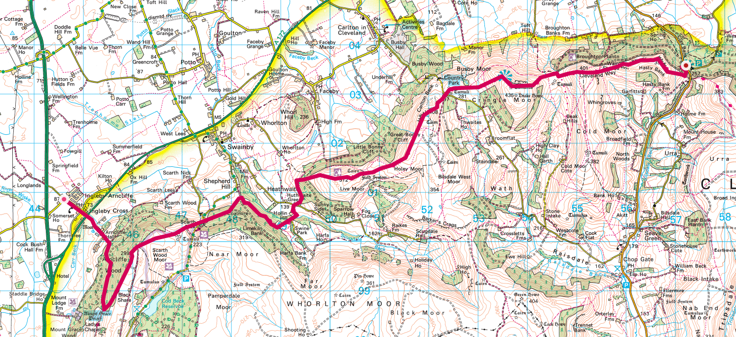
Coast to Coast Day 10 – Ingleby Cross to Clay Bank Top

Track our route live

Coat to coast day 10, whilst relatively short in distance does involve a reasonably hefty climb and hence I’ve added a little more to our forecast time taken. This is also the only place where our accommodation is not directly on the route. There is nowhere to stay at Clay Bank Top and we have to prearrange a pickup from a car park which is in the middle of nowhere where there is no mobile signal. I could of course suggest to the B&B people that they could follow our progress using the live tracking. Maybe I will 🙂

Update

Quite a pleasant walk today with some soreness of foot but heels not as bad as previous days. Gave the blisters an airing last night and redid the plasters this morning.

Last night I called ahead to West Cote B&B as instructed and Judy the landlady offered to pop into town and buy me some Arnica cream. An ice bath and an application of crea later and we shall see whether it has any effect. She also resupplied us with tape and compeed.

Local knowledge is a great thing. The locals in Ingleby Arncliffe considered day 10’s walk to be a seriously hard one. Last night’s B&B folk (Pat and Maurice) showed us a route that took us around the first big climb and ended up being slightly shorter. We also walked directly to West Cote from the Coast to Coast route as opposed to being picked up from Clay Bank Top car park. It was the same distance but took away the need for Stuart to come and pick us up by car. He is going to ferry us back to the path tomorrow morning.

At the junction of the coast to coast path and the road to the B&B there was a cafe called Lordstones where we found it convenient to eat our lunch on their picnic tables. I consumed a jug of iced blackcurrant squash.

The B&B is in a lovely spot next to a working farm. I see lambs, hens and horses in front of me plus a great muck heap to the side. It’s v pleasant sat on the deck writing this update. Judy the landlady is a lovely person and is off tonight to a committee meeting of the riding for the disabled charity.

Starting B&B Ingleside, Ingleby Arncliffe Northallerton DL6 3LN
Forecast/Actual km  18.51/15.36
forecast/actual time  8h/5h (avoided first big climb by walking around it)
weather  overcast but warmish – base layer only for most of walk
forecast/actual ascent m  883.3/354
breakfast  fruit & fibre & 2 bacon sandwiches – did the job fair play & I wasn’t expecting 2 sarnies
lunch  cheese and pickle, scone and butter, banana & piece of cake
dinner
finishing B&B West Cote, Chop Gate TS9 7JF

Link to Coast to Coast walk Day 10 Photo Album. Photos will upload as soon as there is connectivity and I will move them into the shared album each evening when I get to the pub for dinner or if there is a decent connection, periodically as we go along.

While I am walking I will be using Runkeeper to live track my progress. You can find the link for each day’s progress at my twitter page or at my Facebook profile page. I will also be pinning photos within Runkeeper as I progress. I am also using a Fitbit Surge to provide me with additional monitoring data.

Don’t forget I’m raising cash for Cancer Research UK whilst on this Coast to Coast walkJustGiving page here. The start date of the walk coincides with the anniversary of my mother’s death on May 1st last year. Mam was Chairman of the Marown & District branch of the IoM Anti Cancer Association.

Forecast numbers are based on Ordnance Survey mapped route. I add 1 hour for each approx 500m climb plus an hour for lunch.

A lot of people have helped me in the preparation for this walk. Firstly Mat Kiddie of Amigo who I met on a plane coming back from Mobile World Congress and who sent me a mobile battery charger. Then there is Aideen O’Colmain of Fitbit who very generously donated a Surge. Finally there is Dan Cunliffe and his team at Pangea who provided me with a mobile tracking device that allows me to track my progress independently of having to use my phone.

Categories
charitable Coast to Coast Weekend

Coast to Coast walk Day 9 – 23 mile monster

Coast to Coast walk Day 9 – Richmond to Ingleby Cross

Coast to Coast walk day 9 is the longest from a miles covered perspective with a trudge between the Yorkshire Dales and the North Yorks Moors. At the start of this day we are two thirds of the way to the coast.

Richmond by the way is where I bought my walking boots. The AltBerg factory shop is a fantastic spot and a go to place for serious walkers.

Update

We made this a slightly easier day for us by walking some of the miles the day before after we had arrived at Richmond. We met old pal Phippo and his mum Val at the Crown in Broughton on Swale (not sure of the name of the village – keep forgetting it – name of pub is right 🙂 and he gave us a lift back to Richmond.

Taxi picked us up from Willance House at 7am the next day and dropped us off where we had ended the previous one. It was a good job we started early. It was a beautifully cool morning in contrast with the rest of the day which got hot and airless.

Initially it was quite a pleasant walk through mixed farmland and country lanes. There were plenty of new birds to see and a site of scientific interest on the verge that had some yellow flowers that I had seen the day before but never before.

As we moved into arable country the trudge through fields and farm tracks was a long one and hard on the feet. For a long time we saw few people although we did meet a foursome coming the other way who were doing the walk East to west in 19 days – far more sensible. The night before they had stayed at the B&B we were using for the night. We met them at a picnic bench near a farm where the farmer had left a cool box of lucozade sports with an honesty box to leave £1.60.

Slow going as my feet were still hurting.

lots more to say. will update later

A couple of miles out from Ingleby Arncliffe we stopped for a breather and began to be caught up by some of the others we had bumped into on the walk. The two ladies, the Dutch couple Leo and Sandra and our Canadian friends Paul and Lori. Bear in mind we had an early start but were slower walkers than most. (This is down to me and my sore feet!)

We carried on in the company of Paul and Lori picking up the pace a bit after our rest stop. A Cliff Bar and an apple boosted my reserves. The last notable “incident” was the crossing of the A19. This was unbelievably dangerous. A real game of chicken. You wonder why they don’t build a footbridge. There must be tens of thousands of people crossing that road every year.

Our B&B was conveniently on the route into the village and run by a nice retired couple called Pat and Maurice. We waved goodbye to the Canadians who had a little further to go. Paul gave me some ibuprofen gel (Voltarol) to try on my sore feet.

Having showered and removed the bandages from my blisters we sauntered down to the Bluebell Pub – Ajax and Luke happened to be just outside our B&B when we went out. They were staying at a farm some way down the road & not massively enamoured with it.

The two ladies and the Dutch couple were in the pub. Prawn Cocktail, Steak & Chios and a cheesecake washed down with lager and red wine and then to bed.

starting B&B Willance House, 24 Frenchgate Richmond DL10 7AG
forecast/actual km  35.18/ forgot to switch on runkeeper and found later via email that the batteries on my Pangea tracker needed replacing (did next morning) so will have to stick with the forecast version. remember we did 5 miles or so of today’s walk yesterday
forecast/actual time  8h 26mins/ 11hrs +
weather  hot – poss hottest day of year so far. not enough breeze on the hot dusty farm tracks
forecast/actual ascent m  245.7/
breakfast  bacon sandwich, fruit and yoghurt
lunch  ham sandwich, cereal bar & apple (didn’t eat the carrot)
dinner prawn cocktail, steak and chips, cheesecake, lager, red wine
finishing B&B Ingleside, Ingleby Arncliffe Northallerton DL6 3LN

Link to Coast to Coast walk Day 9 Photo AlbumPhotos will upload as soon as there is connectivity and I will move them into the shared album each evening when I get to the pub for dinner or if there is a decent connection, periodically as we go along.

While I am walking I will be using Runkeeper to live track my progress. You can find the link for each day’s progress at my twitter page or at my Facebook profile page. I will also be pinning photos within Runkeeper as I progress. I am also using a Fitbit Surge to provide me with additional monitoring data.

Don’t forget I’m raising cash for Cancer Research UK whilst on this Coast to Coast walkJustGiving page here. The start date of the walk coincides with the anniversary of my mother’s death on May 1st last year. Mam was Chairman of the Marown & District branch of the IoM Anti Cancer Association.

Forecast numbers are based on Ordnance Survey mapped route. I add 1 hour for each approx 500m climb plus an hour for lunch.

A lot of people have helped me in the preparation for this walk. Firstly Mat Kiddie of Amigo who I met on a plane coming back from Mobile World Congress and who sent me a mobile battery charger. Then there is Aideen O’Colmain of Fitbit who very generously donated a Surge. Finally there is Dan Cunliffe and his team at Pangea who provided me with a mobile tracking device that allows me to track my progress independently of having to use my phone.

Categories
charitable Coast to Coast Weekend

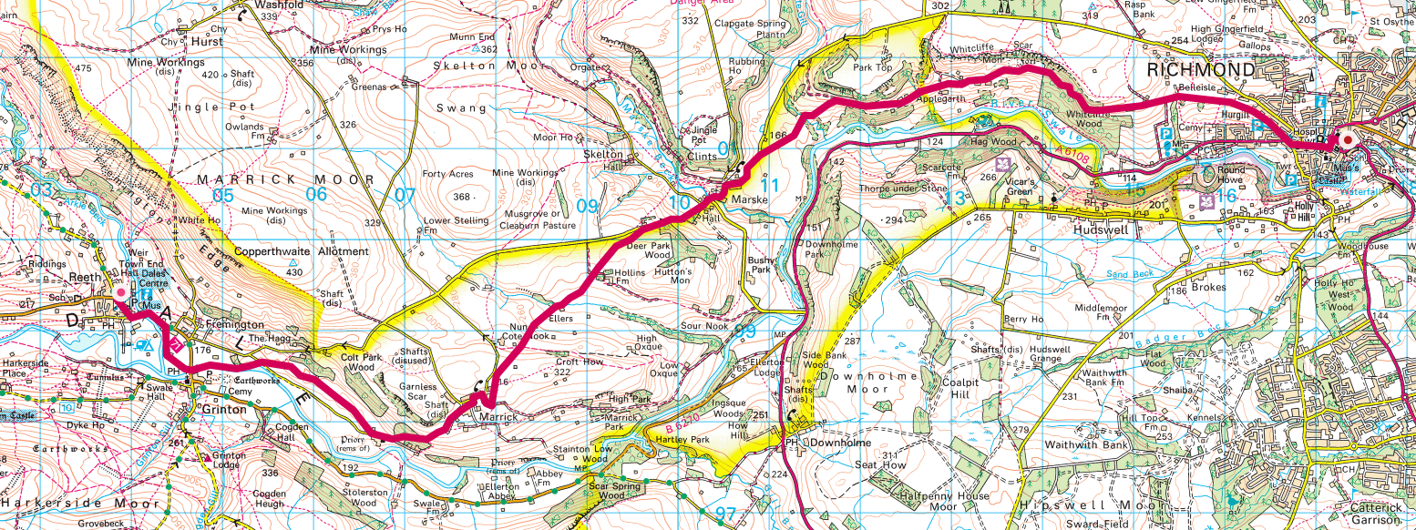
Coast to Coast walk Day 8 – Reeth to Richmond

Coast to Coast walk Day 8 – Reeth to Richmond

Follow today’s progress here.

Day 8 of the Coast to Coast walk and we are into our second week. I already feel like a veteran. This is another relatively short day where we can finish early in Richmond to chill out a little and maybe get some washing done. There is a high road and a low road option here. I’ve gone for the high road based on reckoning I’ll be getting a little fitter by this stage but we shall see.

Update

The Manse B&B was best seen so far. Great room and everything high class.

Hot day for our walk. We started at 9. Luke and Ajax started an hour later but caught us up just before Richmond. Heat was strength sapping. I wore short sleeved base layer and regretted not using long sleeves.

Water just about lasted until Richmond. Tom and I continued for another few miles to meet Phippo and his mum Val at a pub called the Crown. Idea was to make a start on tomorrow’s walk so that we weren’t doing 22 miles in one day. Promises to be another hot one tomorrow. Had dinner with Phippo and Val at a pizza place round the corner from the B&B. Phippo v generously paid.

We are in bed at 8.25 having set our alarms for 6. Bacon sandwich ordered for 6.30. Taxi at 7 to take us to where we finished off today. Willance House B&B also v high standard. Apparently oldest house in Richmond (circa 1400)

starting B&B The Manse, Reeth DL11 6SN
forecast/actual km  16.93/17.47
forecast/actual time  6h 4min/5h 28min
weather scorching hot
forecast/actual ascent m  408.9/306
breakfast  full eng with fried bread – v good
lunch  pork pie & 1 litre of milk
dinner  ribs starter,diavolo pizza (not hot enough) & tiramisu
finishing B&B Willance House, 24 Frenchgate Richmond DL10 7AG

Link to Coast to Coast walk Day 8 Photo AlbumPhotos will upload as soon as there is connectivity and I will move them into the shared album each evening when I get to the pub for dinner or if there is a decent connection, periodically as we go along.

While I am walking I will be using Runkeeper to live track my progress. You can find the link for each day’s progress at my twitter page or at my Facebook profile page. I will also be pinning photos within Runkeeper as I progress. I am also using a Fitbit Surge to provide me with additional monitoring data.

Don’t forget I’m raising cash for Cancer Research UK whilst on this Coast to Coast walkJustGiving page here. The start date of the walk coincides with the anniversary of my mother’s death on May 1st last year. Mam was Chairman of the Marown & District branch of the IoM Anti Cancer Association.

Forecast numbers are based on Ordnance Survey mapped route. I add 1 hour for each approx 500m climb plus an hour for lunch.

A lot of people have helped me in the preparation for this walk. Firstly Mat Kiddie of Amigo who I met on a plane coming back from Mobile World Congress and who sent me a mobile battery charger. Then there is Aideen O’Colmain of Fitbit who very generously donated a Surge. Finally there is Dan Cunliffe and his team at Pangea who provided me with a mobile tracking device that allows me to track my progress independently of having to use my phone.

Categories
charitable Coast to Coast Weekend

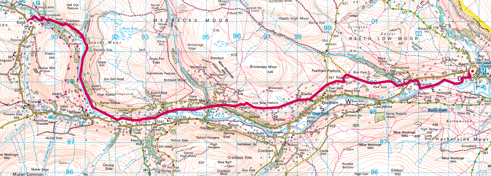
Coast to Coast walk day 7 – Yorkshire Dales

Coast to Coast walk Day 7 – Keld to Reeth

Track today’s walk live.

Day 7 of the Coast to coast walk is another shortun with what is notionally  gentle stroll between Keld and Reeth. There are two route options though. There is the high road taking in the mines or the low road along the river Swale. Both are nice walks.

The distances and elevation used here assume the river route as the weather forecast is not good and Alfred Wainwright recommends we avoid the higher routes if it is wet. This may be a bit of a copout and we may well feel like going for the climb after the acclimatisation of the previous few days. We shall see.

Update

Swaledale is a beautiful valley, especially in its upper reaches. Idyllic. No mobile signal and crappy broadband but hey…

Fried bread with breakfast was a first. We were pretty impressed with the Keld Lodge Hotel. Just the job. The manager Dave (owner?) was a real character and most helpful.

Keld is just a tiny hamlet in the middle of nowhere and so far probably my fave place to stay. We had a good dinner. I had grilled goats cheese followed by braised steak and then  cheese board – all local cheese. Wine was good. Everyone enjoyed themselves.

Everyone staying at the Lodge was a coast to coaster so we all had stories to tell. Ajax and Luke were at another b&B down the road but came to us to eat. Paul and Lori the Canadians from Patterdale and the New Ing Lodge in Shap were also there.

Feet still hurt btw. I put new blister plasters on this morning and am hoping that by tomorrow they will start getting properly hardened up. They need to be on form for the 22 miler from Richmond to Ingleby Arncliffe. Pace at the mo is still too slow.

Starting B&B Keld Lodge Hotel, Keld DL11 6LL
forecast/actual km  18.98/20.11
forecast/actual time  6h 36min/7h 06min
weather beautiful sunny day
forecast/actual ascent m  484.1/723
breakfast  full english no eggs but with fried bread!
lunch  ham sandwich at the pub in Gunnersbury
dinner
finishing B&B The Manse, Reeth DL11 6SN

Link to Coast to Coast walk Day 7 Photo AlbumPhotos will upload as soon as there is connectivity and I will move them into the shared album each evening when I get to the pub for dinner or if there is a decent connection, periodically as we go along.

While I am walking I will be using Runkeeper to live track my progress. You can find the link for each day’s progress at my twitter page or at my Facebook profile page. I will also be pinning photos within Runkeeper as I progress. I am also using a Fitbit Surge to provide me with additional monitoring data.

Don’t forget I’m raising cash for Cancer Research UK whilst on this Coast to Coast walkJustGiving page here. The start date of the walk coincides with the anniversary of my mother’s death on May 1st last year. Mam was Chairman of the Marown & District branch of the IoM Anti Cancer Association.

Forecast numbers are based on Ordnance Survey mapped route. I add 1 hour for each approx 500m climb plus an hour for lunch.

A lot of people have helped me in the preparation for this walk. Firstly Mat Kiddie of Amigo who I met on a plane coming back from Mobile World Congress and who sent me a mobile battery charger. Then there is Aideen O’Colmain of Fitbit who very generously donated a Surge. Finally there is Dan Cunliffe and his team at Pangea who provided me with a mobile tracking device that allows me to track my progress independently of having to use my phone.

Categories
charitable Coast to Coast Weekend

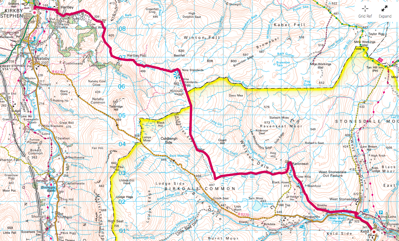
Coast to Coast walk Day 6 – a shortie to Keld

Coast to Coast walk Day 6 – Kirkby Stephen to Keld

Click here to follow today’s walk.

Day 6 of the coast to coast walk was the first shortish day spent walking between Kirby Stephen and Keld. In my forecasts I still had us taking over 6 1/2 hours which is down to the fact that there is some elevation built into this leg and also that I am as previously reported a slow walker (short legs!).

The highpoint of this day is passing Nine Standards Rigg which is the halfway mark and is also the watershed, after which the rivers start to flow East instead of West.

Update:

We didn’t follow the prescribed route today. Gave the knee a rest by following the road that runs parallel. It’s what Wainwright tells you to take if the weather is bad at the top.

The Fletcher House B&B was a nice building. Breakfast was nothing to write home about but ok and we when we went down at 8am we were hit with the statement “oh by the way they are coming to pick up your bags at 8.15”. Back to the room we went to pack.

At breakfast we met the person who runs Packhorse – the baggage porting company. Came in to chat. He told us they were growing and booked between 10k and 15k room nights (can’t remember exactly).

Afterwards we picked up our lunch, some blister plasters from the outdoor shop and some paracetamol and after sun from the chemist.

Bumped into Ajax and Luke and then set off in our separate directions. They up to 9 Standards and we along the road. It was a lovely walk. Very scenic. Quite a long uphill section but nothing unmanageable.

We saw lapwings (farmer’s wife told me what they were). The same farmers wife advised me to pick some wool from the hedge and use it in my boots to cushion the impact. I’ve picked a pocket full. Their farm has 1300 breeding ewes – 2,000+ lambs a year.

The walk down along the river Swale was absolutely delightful and we are now ensconced in the residents lounge of the Keld Lodge Hotel having a beer and doing this update. Ajax and Luke are staying next door and are swinging by for dinner at 7.

Outside we met a chap called Richard who has just retired from the police force. He is doing the Lands End to John O’Groats walk. 1200 miles in 60 days. Work out the average!!!

starting B&B Fletcher House, Fletcher Hill Market Street, Kirkby Stephen CA17 4QQ
forecast/actual km  18.1/16.91
forecast/actual time  6h 37min/5h 40min
weather  beautiful sunny day with a breeze
forecast/actual ascent m  604.80/595
breakfast  toasted bacon sandwich and bowl of fruit
lunch  cheese and onion sandwich from coop plus orange, mars bar and pack of BBQ beef flavour beef
dinner
finishing B&B Keld Lodge Hotel, Keld DL11 6LL

Link to Coast to Coast walk Day 6 Photo AlbumPhotos will upload as soon as there is connectivity and I will move them into the shared album each evening when I get to the pub for dinner or if there is a decent connection, periodically as we go along.

While I am walking I will be using Runkeeper to live track my progress. You can find the link for each day’s progress at my twitter page or at my Facebook profile page. I will also be pinning photos within Runkeeper as I progress. I am also using a Fitbit Surge to provide me with additional monitoring data.

Don’t forget I’m raising cash for Cancer Research UK whilst on this Coast to Coast walkJustGiving page here. The start date of the walk coincides with the anniversary of my mother’s death on May 1st last year. Mam was Chairman of the Marown & District branch of the IoM Anti Cancer Association.

Forecast numbers are based on Ordnance Survey mapped route. I add 1 hour for each approx 500m climb plus an hour for lunch.

A lot of people have helped me in the preparation for this walk. Firstly Mat Kiddie of Amigo who I met on a plane coming back from Mobile World Congress and who sent me a mobile battery charger. Then there is Aideen O’Colmain of Fitbit who very generously donated a Surge. Finally there is Dan Cunliffe and his team at Pangea who provided me with a mobile tracking device that allows me to track my progress independently of having to use my phone.

Categories
charitable Coast to Coast Weekend

Coast to Coast walk Day 5 – long haul between National Parks

Coast to Coast walk Day 5 – Shap to Kirkby Stephen

Click here to track today’s walk

Day 5 of the coast to coast walk is a longun and considered to be a bit of a trudge between the Lake District and the Yorkshire Dales. Actually, whilst we have left the most scenic bit of the route, I am quite looking forward to mentally switching off and just concentrating on putting one foot in front of another and reeling in the miles.

I have budgeted almost ten hours for this day. hopefully it will take less but I am not the fastest of walkers – short legs etc.

The New Ing Lodge breakfast wasn’t great. Shame really as the building has real potential. We set off earlier than Ajax and Luke but went the wrong way and they caught us up after we retraced our steps.We walked together thereafter. Boy was it tough. It was 20 miles off road on a hot day. Feet and knee were an issue and water became one. We had to cut down on our consumption.

Got to KS very tired and went straight to the pub for rehydration. Fortunately the pub was only a hundred yards from the B&B and Tom hobbled over to get the key. I was totally exhausted and my feet were very sore. I soon started to shiver and had to put a fleece and my waterproof on to keep warm.

Whilst we were there there was a pub quiz. I got Bertrand Russell right. Bed.

Starting B&B New Ing Lodge, Shap, CA10 3LX
Forecast/Actual miles  33.08/32.27
Forecast/Actual time hrs  9h 38min/10h 3min
Weather Nice start with cooling breeze turning out v sunny – base layer weather
Elevation forecast/actual  612/697
Breakfast  Not outstanding full English. One piece of bacon, not fried. No drying facilities. Heating not on and bar not open when we got back from dinner.
Lunch Tuna sandwiches
Dinner Cheese burger in Black Bull in KS. Few pints of Black Sheep.
Finishing B&B Fletcher House, Fletcher Hill Market Street, Kirkby Stephen CA17 4QQ

Link to Coast to Coast walk Day 5 Photo Album. Photos will upload as soon as there is connectivity and I will move them into the shared album each evening when I get to the pub for dinner or if there is a decent connection, periodically as we go along.

While I am walking I will be using Runkeeper to live track my progress. You can find the link for each day’s progress at my twitter page or at my Facebook profile page. I will also be pinning photos within Runkeeper as I progress. I am also using a Fitbit Surge to provide me with additional monitoring data.

Don’t forget I’m raising cash for Cancer Research UK whilst on this Coast to Coast walkJustGiving page here. The start date of the walk coincides with the anniversary of my mother’s death on May 1st last year. Mam was Chairman of the Marown & District branch of the IoM Anti Cancer Association.

Forecast numbers are based on Ordnance Survey mapped route. I add 1 hour for each approx 500m climb plus an hour for lunch.

A lot of people have helped me in the preparation for this walk. Firstly Mat Kiddie of Amigo who I met on a plane coming back from Mobile World Congress and who sent me a mobile battery charger. Then there is Aideen O’Colmain of Fitbit who very generously donated a Surge. Finally there is Dan Cunliffe and his team at Pangea who provided me with a mobile tracking device that allows me to track my progress independently of having to use my phone.

Categories
charitable Coast to Coast Weekend

Coast to Coast walk Day 4 – the climb to Kidsty Pike

Coast to Coast walk Day 4 – Patterdale to Shap

Track today’s walk live.

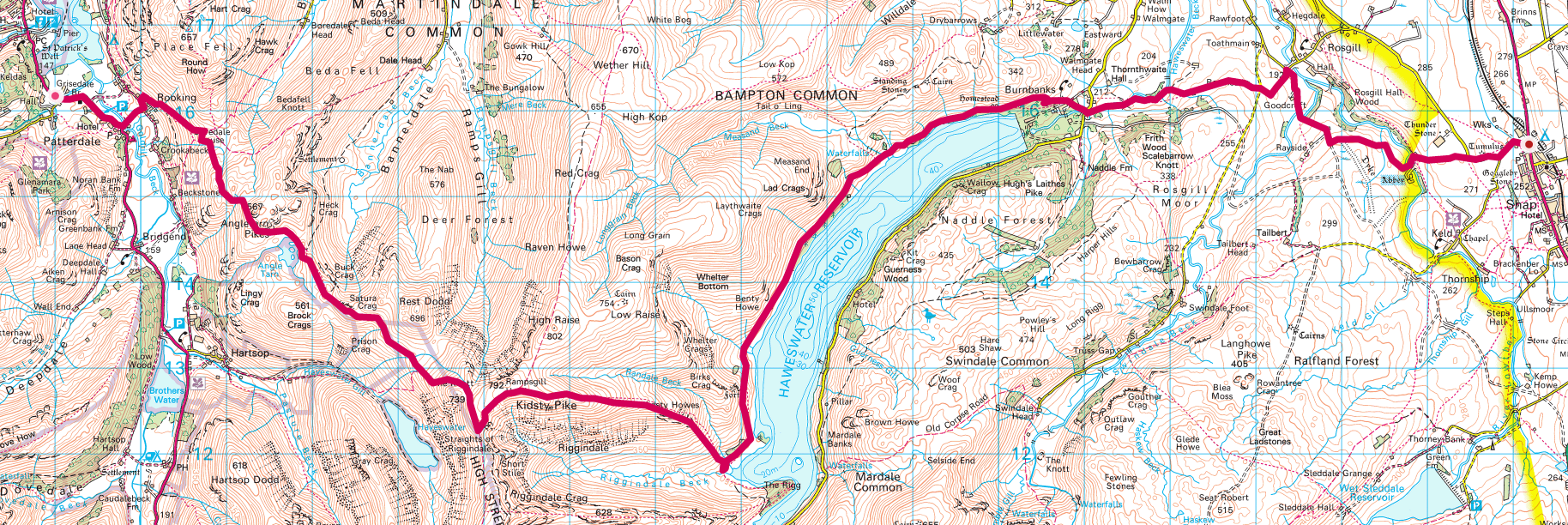
The Coast to Coast walk Day 4 was rated by Wainwright himself as the toughest. The guidebooks reckon this is a 965m climb but my route plotted using the Ordnance Survey online took suggests it is more like 1,152m. I don’t think I’m choosing a harder route for the sake of it. It may be down to more modern tech being used in the planning. We shall see.

This also happens to be my lovely wife Anne’s birthday so she is coming to meet us and stay the night at Shap.

We start with a long gradual climb to Kidsty Pike, down to Haweswater alongside which is then a long stretch to Shap Abbey and our B&B.

Updatye

This was a toughie with the added pressure that Anne was joining us to celebrate her birthday. We decided to take the Wainwright avoid the mountain route which was 19 miles (3 miles more than the mountain route) . The start, around Ullswater was a killer on the feet and took much longer than expected. We rerouted to use roads and rejoined the “official” Wainwright route before Shap Abbey.

Anne had just arrived when we got there. Was great to see her. Ajax and Luke weren’t far behind. Their route had been a tough one. We hadna couple of beers in the bar of the New Ing Lodge and then went out for a sit down fish and chips in the local chipped. Luke and I popped over the rroad to the coop to buy beer and wine.

Ended up in the (cold) lounge of the B&B to eat a birthday cake that Anne had bought cheap from Tesco. A good finsih to the day.

Final note – the Canadian couple, Paul and Laurie, we had met in the White Lion in Patterdale were also at the New Ing Lodge and joined us for some cake.

starting B&B Grisedale Lodge, Grisedale Bridge, Patterdale CA11 0PJ
forecast/actual km  24.74/30.40 (guesswork as runkeeper stopped)
forecast/actual time  9h 52min/
weather  nice day
forecast/actual ascent m  1,152.5
breakfast  best to far – home made bread, good bacon, meaty Cumberland sausage
lunch  Cheese and pickle sandwich
dinner  fish and chips in local chippy
finishing B&B New Ing Lodge, Shap, CA10 3LX

Link to Coast to Coast walk Day 4 Photo Album. Photos will upload as soon as there is connectivity and I will move them into the shared album each evening when I get to the pub for dinner or if there is a decent connection, periodically as we go along.

While I am walking I will be using Runkeeper to live track my progress. You can find the link for each day’s progress at my twitter page or at my Facebook profile page. I will also be pinning photos within Runkeeper as I progress. I am also using a Fitbit Surge to provide me with additional monitoring data.

Don’t forget I’m raising cash for Cancer Research UK whilst on this Coast to Coast walkJustGiving page here. The start date of the walk coincides with the anniversary of my mother’s death on May 1st last year. Mam was Chairman of the Marown & District branch of the IoM Anti Cancer Association.

Forecast numbers are based on Ordnance Survey mapped route. I add 1 hour for each approx 500m climb plus an hour for lunch.

A lot of people have helped me in the preparation for this walk. Firstly Mat Kiddie of Amigo who I met on a plane coming back from Mobile World Congress and who sent me a mobile battery charger. Then there is Aideen O’Colmain of Fitbit who very generously donated a Surge. Finally there is Dan Cunliffe and his team at Pangea who provided me with a mobile tracking device that allows me to track my progress independently of having to use my phone.

Categories
charitable Coast to Coast Weekend

Coast to Coast walk Day 3 – 2 big climbs – urgh

Coast to Coast walk Day 3 – Rosthwaite to Patterdale

Click here to track the walk

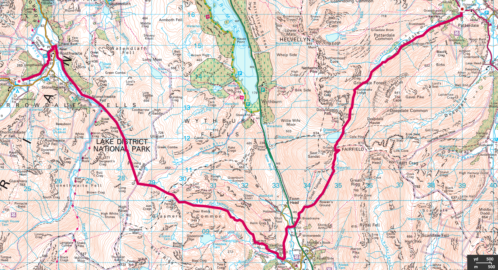
Coast to Coast walk day 3 was always going to be one of the toughest. It involves two big climbs and is often split into two days walks by people with far more sense than us.

So today we expected to be one of the most knackering but perhaps one of the most satisfying to complete.

The first section involves climbing out of Borrowdale up Greenup Edge and down into Wordsworth’s Grasmere. We don’t have time to stop at Grasmere but turn left to ascend to Grisedale Tarn and thence down the “easy” route towards Patterdale (notionally avoiding Helvellyn and St Sunday Crag – wimps I know).

Update:

Left knee took a serious battering coming down from Honister Pass yesterday. I’ve never had a problem with it before but picked up a twinge on day 1 and the weakness was exploited by the mountain on day 2. In consequence we caught a cab to Keswick first thing after breakfast to buy a knee support.

The Glaramara Outward bound centre we stayed at turned out to be great. It had a seriously good drying room and the bacon at breakfast was the best we have seen so date. They had also kept us some food as the restaurant closed at 7pm – bit early I thought.

Ajax and Luke were outside when we turned up in the taxi – took some photos! They were too late for the restaurant themselves but we hadn’t realised that they weren’t actually staying in the same place as us. They got in our taxi and had a free ride to the pub. We only found out the next morning they were staying somewhere else. Not v good apparently.

In the morning we bought a map. Tom and I had decided it was a big ask to do the planned route for the day and had decided to find a suitable alternative. Wainwright doesn’t really prescribe a specific route. Just makes suggestions. We wanted to make sure our chosen route did justice to the purpose of the trip and chose an 18 mile walk to Patterdale from Keswick, going around the mountains.

The walk turned out long but took us through some pleasant farmland (lots of lambs). the first part ended at Troutbeck where we had planned to stop at the pub. Unfortunately they were closed for fire drill training. we ate our lunch at one of their picnic tables and set off on the road to Ullswater. It was a fair old crack but the road, which was an A road wasn’t too busy.

We hit Ullswater just as the National Trust caff was closing. Huh. There was another 4 miles to go so we just ploughed on. Tom had some bad blisters and when we arrived at the B&B he hit the hay. Ajax and Luke arrived half an hour after us after a very difficult walk.

We hit the White Lion for dinner and I had chilli con carne.

The Grisedale Lodge B&B was pretty outstanding. Christine served us home made break, very good bacon and a seriously meaty cumberland sausage. Best breakfast so far.

Check out our coast to coast day 3 video.

starting B&B The Glaramara Centre, Seatoller, Borrowdale CA12 5XQ
forecast/actual km  24.36/28.14
forecast/actual time  9h 47min/8 h 52min
weather  lovely day for walking
forecast/actual ascent m  1,149.7/654
breakfast  great bacon
lunch  tuna sandwich from Greggs in Keswick
dinner  chilli con carne at White Lion in Patterdale plus a few startery bits
finishing B&B Grisedale Lodge, Grisedale Bridge, Patterdale CA11 0PJ

Link to Coast to Coast walk Day 3 Google Photo Album. Photos will upload as soon as there is connectivity and I will move them into the shared album each evening when I get to the pub for dinner or if there is a decent connection, periodically as we go along.

While I am walking I will be using Runkeeper to live track my progress. (When network coverage allows) You can find the link for each day’s progress at my twitter page or at my Facebook profile page. I will also be pinning photos within Runkeeper as I progress. I am also using a Fitbit Surge to provide me with additional monitoring data.

Don’t forget I’m raising cash for Cancer Research UK whilst on this Coast to Coast walkJustGiving page here. The start date of the walk coincides with the anniversary of my mother’s death on May 1st last year. Mam was Chairman of the Marown & District branch of the IoM Anti Cancer Association.

Forecast numbers are based on Ordnance Survey mapped route. I add 1 hour for each approx 500m climb plus an hour for lunch.

A lot of people have helped me in the preparation for this walk. Firstly Mat Kiddie of Amigo who I met on a plane coming back from Mobile World Congress and who sent me a mobile battery charger. Then there is Aideen O’Colmain of Fitbit who very generously donated a Surge. Finally there is Dan Cunliffe and his team at Pangea who provided me with a mobile tracking device that allows me to track my progress independently of having to use my phone.

Categories
charitable Coast to Coast Weekend

Coast to Coast walk Day 2 – into the Lake District

Coast to Coast walk Day 2 – Ennerdale Bridge to Rosthwaite

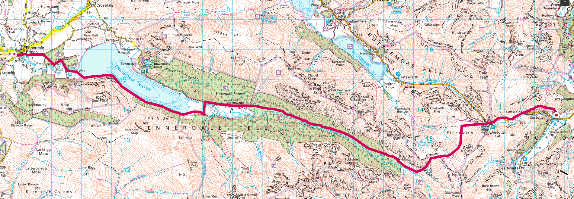
Coast to coast walk day 2 involves our first day in the Lake District. The day looks like having an easy start with a walk along Ennerdale Water, onwards alongside the River Liza and through Ennerdale Forest. We pass the famous Black Sail Youth Hostel and then begin what looks like a killer climb up Loft Beck to Honister Hause and the slate mine.

I’m anticipating stopping for lunch at the top of Loft Beck. In fact we will need to plan what process we expect to have made by what time for each day. I’m not a fast walker at the best of times and will need to make sure we keep up the pace. Don’t want to be arriving at the b&B in the dark each day.

We will also have to have the contingency plan for each day sorted in advance. Alfred Wainwright himself advises against taking the high routes if the mountains are shrouded in cloud. I’m not sure there is always a practice alternative.

There is a caff at the slate mine so we will no doubt avail ourselves of a hot cuppa therein. Apparently they also have log fires.

We will still have a fair old descent before arriving in the B&B for the night. Although the day is touter as Ennerdale Bridge to Rosthwaite we don’t quite make it as far as Rosthwaite but are stopping at Seatoller. I quite like the name Seatoller :).

Update

Was a wet start to the day but the forecast was for it to improve which it did. We set off around the South side of Lake Ennerdale which was very slow going with the path often flooded with the previous day’s rain. Took us quite a while to get past the lake and we then crossed the magnificent river liza in full flood. It’s not a long river but quickly fills up from the hills around.

The notion of stopping for lunch at the top of Loft Beck was pure fantasy.We stopped in a clearing in Ennerdale Forest at around 2pm. The walk was a long haul though the forest with little to tell you how much progress you were making. Tom reminds me of a funny incident.

A fell runner was ploughing his way past us and I jokingly said to him “faster”. Unfortunately he couldn’t hear me because of his earphones so he stopped and took them off. Oops. The exact opposite of what I was suggesting.

We arrived at The Black Sail Youth Hostel at around 3pm.10 miles in to the walk. It’s impressively remote. Had a cup of tea and a 30 min break chatting to other adventurers. After setting off again at 3.30 it took us 45 minutes to find Loft Beck, which was where we were to climb. Impressive mountain stream. Took us an hour to get to the top which I was pleased with. Incredible views.

Thats where the difficulties began. Really difficult terrain that seriously pounded the knees and exacerbated a niggle I picked up yesterday. Moreover whereas it looks like quite a small plateau on the map in reality it was a fairly long distance to travel. You wouldn’t want to be stuck up there in cloud.

My knee gradually got worse and to cut a long story short it was gone 7.30 before we got to the quarry visitor centre, long closed for the day. We passed the youth hostel near to the visitor centre to find three lads waving at us. We had seen them at Black Sail.

Although it was only 2 miles to Seatoller it was all downhill, which is what was causing problems for the knee. We called in the hostel and they called a cab – cost £18 because it had to come from Keswick! Had a welcome beer whilst we waited. I’ll finish off this story another day.

Check out the coast to coast day 2 video.

starting B&B  Thorn Trees, Ennerdale Bridge, CA23 3AR
forecast/actual km  21.17/22.56
forecast/actual time  6hrs 16min/11h 33min – wow see notes
weather  wet to start but turned out nice
forecast/actual ascent m  625.4/630
breakfast  another full English
lunch cheese and pickle sandwich
dinner  soup, ham sandwich and a trifle – the kitchen closed well before we arrived but they looked after us.
finishing B&B  The Glaramara Centre, Seatoller, Borrowdale CA12 5XQ

Link to Coast to Coast walk Day 2 Google Photos Album. Photos will upload as soon as there is connectivity and I will move them into the shared album each evening when I get to the pub for dinner or if there is a decent connection, periodically as we go along.

While I am walking I will be using Runkeeper to live track my progress. You can find the link for each day’s progress at my twitter page or at my Facebook profile page. I will also be pinning photos within Runkeeper as I progress. I am also using a Fitbit Surge to provide me with additional monitoring data.

Don’t forget I’m raising cash for Cancer Research UK whilst on this Coast to Coast walkJustGiving page here. The start date of the walk coincides with the anniversary of my mother’s death on May 1st last year. Mam was Chairman of the Marown & District branch of the IoM Anti Cancer Association.

Forecast numbers are based on Ordnance Survey mapped route. I add 1 hour for each approx 500m climb plus an hour for lunch.

A lot of people have helped me in the preparation for this walk. Firstly Mat Kiddie of Amigo who I met on a plane coming back from Mobile World Congress and who sent me a mobile battery charger. Then there is Aideen O’Colmain of Fitbit who very generously donated a Surge. Finally there is Dan Cunliffe and his team at Pangea who provided me with a mobile tracking device that allows me to track my progress independently of having to use my phone.

—–Update—–

Tref and the team are falling victim of the limited connectivity on the first few days of the walk. They’ve had some appalling wet weather in the lake district and are very soggy but undeterred nonetheless. Below is a video of the first two days that I’ve put together using the clips that dad has managed to share with me but hasn’t been able to post. Let’s hope they can get a decent connection at their next stop over.

– Joe Davies


Categories
charitable Coast to Coast Weekend

Coast to Coast Day 1 – St Bees to Ennerdale Bridge

Coast to Coast walk Day 1 – dipping our toes in the Irish Sea

Click here to track our progress live

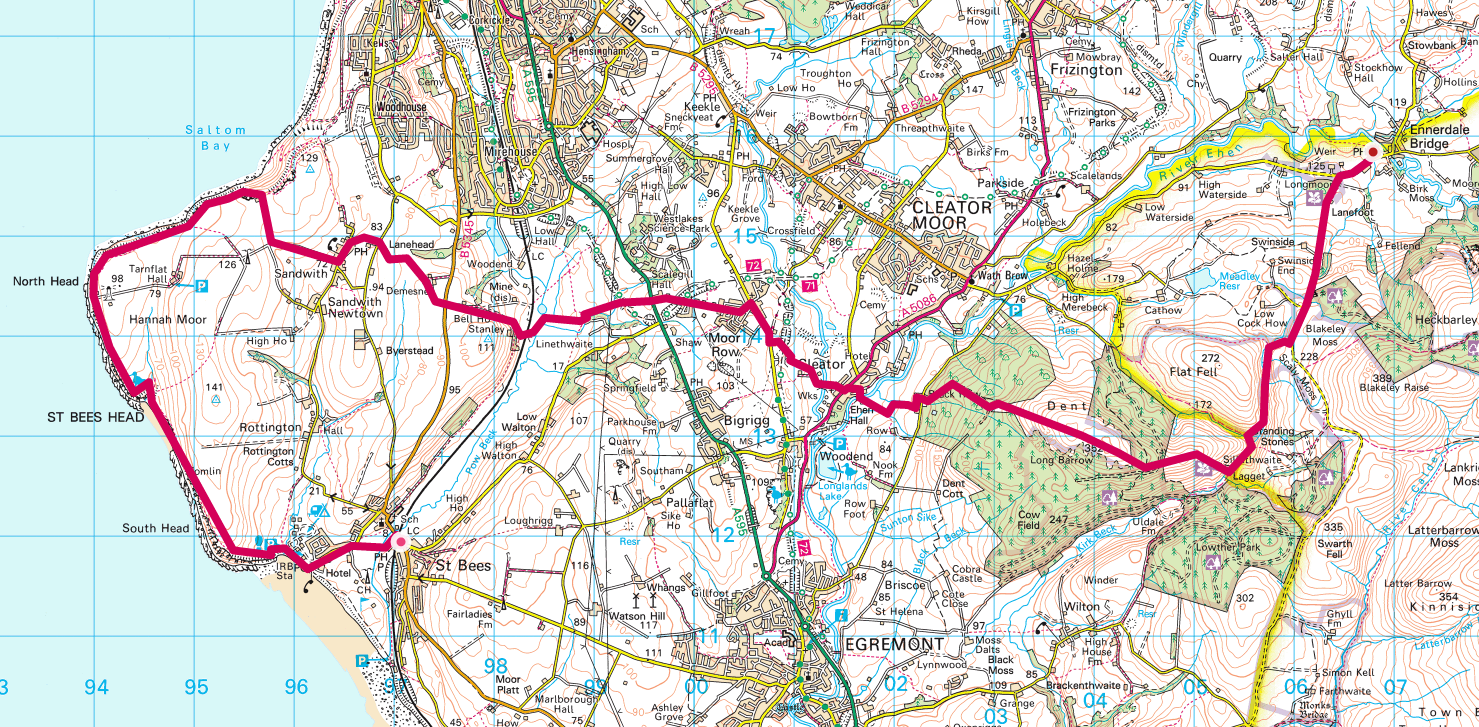
Coast to Coast walk day 1 involves dipping our boots into the sea at St Bees. A short climb up to St Bees Head with Hannah Moor to our right. Weather permitting we should be able to see the Isle of Man on the horizon and the Winscale (Sellafield) nuclear power station. They renamed it from Winscale when I was a kid to avoid the bad reputation it had gained. We walk around the headland past the lighthouse and then proceeding inland towards Ennerdale Bridge.

At Cleator the perceived wisdom is that we stop at the Cleator Family Store to support the local economy. They have a walkers log book to sign. It will be interesting to see how many have been before us this year. The walking season is only just beginning.

We are using the Martin Wainwright Coast to Coast Walk guide book. No relation to Alfred Wainwright. The guide book suggests there is a 705m climb (775m according to the Ordnance Survey route I’ve plotted) on this day. I think there are few days that don’t involve going upwards which is going to be the real test of my fitness. The first real climb starts here up Cleator Moor where, at the top of which, we should get a good view looking back at the coast.

Our final destination today is Ennerdale Bridge which the book says is 13.8 miles (22.1km) in. I think this should be a nice manageable start to the adventure.

I’ll post an update this evening to tell you how I got on.

Update

What a start to the odyssey. The day began in a raging gale and ended up in a raging gale. The runkeeper live tracking stopped, probably due to zilch connectivity, the phone eventually ran out of battery and wouldn’t recharge using an external battery. This became a problem when we thought we might be lost – at 6.30 pm. I also dropped the phone and smashed the back of it – not sure what that does to the waterproof qualities. I also lost my specs having removed them on top of St Bees head to get better visibility. There was nowhere dry to stop for lunch, or any break really and we didn’t eat much of our packed lunch (ham sandwiches & accessories). The walk up Dent was a killer with zero visibility at the top and where we had to resort to the use of the compass – a couple staying at the B&B said they avoided Dent and it took them an hour and a half from Cleator (took us 4hrs 10 minutes. Nannycatch Brook was mostly flooded with many fords that might normally be an easy crossing being raging torrents. The boots got wet at that point if they weren’t already. This morning the boots are still wet and I’ve changed the paper on mine and Tom’s. There is zero connectivity – either mobile or fixed. The B&B’s phone line is down and even in the pub the wifi was so slow as to be unusable.

Ajax and Luke got in at 5.30!

The positive points? We got the worst of the weather out of the way and we finished a day that turnedo ut to be a real challenge. We staggered down to the Fox and Hounds and had food with the Agius’. I had a steak and ale pie with chips and veg. Tom had gammon steak. We saw lots of sheep but bugger all else and Tom was invaluable with his map reading.

Monday is another day. The forecast is rainy for the morning but clearing u thereafter. See how it goes.

starting B&B  Stonehouse Farm, 133 Main St St Bees CA27 0DE
forecast/actual km  23.14/23.25
forecast/actual time  7hr 55mins/8hrs 6mins
weather  atrocious – driving rain gale force winds
forecast/actual ascent m  775.7/880
breakfast  full English, did the job.
lunch  ham roll & stuff
dinner  steak pie and chips in fox & houns Ennerdale Bridge. Top notch
finishing B&B  Thorn Trees, Ennerdale Bridge, CA23 3AR – helpful

Link to Coast to Coast walk Day 1 Google Photos Album. Photos will upload as soon as there is connectivity and I will move them into the shared album each evening when I get to the pub for dinner or if there is a decent connection, periodically as we go along.

While I am walking I will be using Runkeeper to live track my progress. You can find the link for each day’s progress at my twitter page or at my Facebook profile page. I will also be pinning photos within Runkeeper as I progress. I am also using a Fitbit Surge to provide me with additional monitoring data.

Don’t forget I’m raising cash for Cancer Research UK whilst on this Coast to Coast walkJustGiving page here. The start date of the walk coincides with the anniversary of my mother’s death on May 1st last year. Mam was Chairman of the Marown & District branch of the IoM Anti Cancer Association.

Forecast numbers are based on Ordnance Survey mapped route. I add 1 hour for each approx 500m climb plus an hour for lunch.

A lot of people have helped me in the preparation for this walk. Firstly Mat Kiddie of Amigo who I met on a plane coming back from Mobile World Congress and who sent me a mobile battery charger. Then there is Aideen O’Colmain of Fitbit who very generously donated a Surge. Finally there is Dan Cunliffe and his team at Pangea who provided me with a mobile tracking device that allows me to track my progress independently of having to use my phone.

Categories
charitable Coast to Coast Weekend

Coast to Coast Walk Day 0 – the journey to St Bees

Coast to Coast walk day 0

Track my progress to the St Bees starting point live

Coast to coast walk day 0 is basically me getting to St Bees for the start of the journey

Didn’t get much sleep last night. Kept getting up to go to the loo. The excitement starting to take effect.

Had a good cooked breakfast – it’s the way ahead for the next couple of weeks:) Thought I might as well start as I am clearly going to be doing going on. Didn’t take long to finish packing and decided I’d take my Osprey laptop bag as it will be easier to keep all the cables there. I can put the bag inside my NorthFace base camp duffel bag for transportation between venues. There’s a lot more stuff in there than if i was carrying it all on the walk.

At 10.30 we set off to drop the duffel bag at Ajax’s house. They are taking it up for me which will make life a lot easier on the journey there. First stop is Newcastle at 13.40 where I’m meeting Joe for 40 minutes during the layover. It’s then a 90 minute journey across to Carlisle and then an hour and ten minutes or so to St Bees where I will arrive at 17.55, all being well.

Had a flat white and a piece of caramel shortbread at Newark Northgate – starting the calorie consumption already:)

At “Darlo” the train filled up with NUFC fans who had already been “celebrating” for some time. They filled up the std class carriages and overflowed into first. We were all getting off quite soon so it didn’t really matter other than some chap who got on at Durham and started talking loudly to a pal about the wallpaper he had just put up, the fact that Newcastle Brown Ale was nearly three quid a bottle at the station whereas it was 4 of a fiver at ASDA and about the fact that he was sitting in first with a sdt class ticket.

We’ve all done it although my incident a few years ago was totally inadvertent. I thought I had a first class ticket and didn’t discover my mistake until after I’d eaten a full breakfast. I was quite prepared to pay to upgrade but the guard never came along to inspect my ticket – result!

I’ll update as we go along here.


While I am walking I will be using Runkeeper to live track my progress. You can find the link for each day’s progress at my twitter page or at my Facebook profile page. I will also be pinning photos within Runkeeper as I progress. I am also using a Fitbit Surge to provide me with additional monitoring data.

Don’t forget I’m raising cash for Cancer Research UK whilst on this Coast to Coast walkJustGiving page here. The start date of the walk coincides with the anniversary of my mother’s death on May 1st last year. Mam was Chairman of the Marown & District branch of the IoM Anti Cancer Association.

A lot of people have helped me in the preparation for this walk. Firstly Mat Kiddie of Amigo who I met on a plane coming back from Mobile World Congress and who sent me a mobile battery charger. Then there is Aideen O’Colmain of Fitbit who very generously donated a Surge. Finally there is Dan Cunliffe and his team at Pangea who provided me with a mobile tracking device that allows me to track my progress independently of having to use my phone.

coast to coast

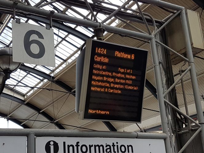
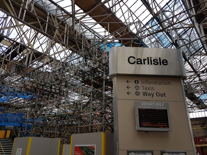
Pics from Carlisle station

carlisle

empty_station

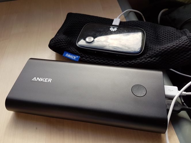
Anker PowerCore charging two devices on the train to St Bees – a nice feeling.

powercore

Arrived in St Bees at exactly 17.55 as timetabled. Nice run along the coast. Lots of village names I’d never heard of. A lot of folk got on at Whitehaven in party mood. The Stonehouse Farm B&B was right next to the station. Carole Smith met me and showed me to Room1. Ordered packed lunches for the morning. Ham rolls, fruit and juice. Breakfast at 8.15 – they already have a party of five at 8am.

Before the others arrived (an hour after me) I strolled down to the beach which is the start of the coast to coast. I figured the weather today is nice whereas tomorrow it will be horrendous. Might as well get some nice pics in before the rain.

Dinner at the Queens Head. Manor Hotel was fully booked. It was fine – 4 pints of Lancaster Bomber and a 16oz gammon, egg and chips. Bed at 9.30.

B&B wifi 19.44Mbps down 4.93Mbps up. EE mobile hotspot 3.58Mbps down 1.36Mbps up.

Categories
charitable Coast to Coast travel Weekend

Coast to coast walk weather forecast

Coast to coast weather forecast ain’t particularly good

The coast to coast weather is always pretty hit and miss. This is the UK after all and we are talking about the Lake District as a starting point. The average number of days with rain in the Lake District in May is 16. The rest of the walk isn’t much better. It’s 14 days in both the Yorkshire Dales and the North Yorks Moors.

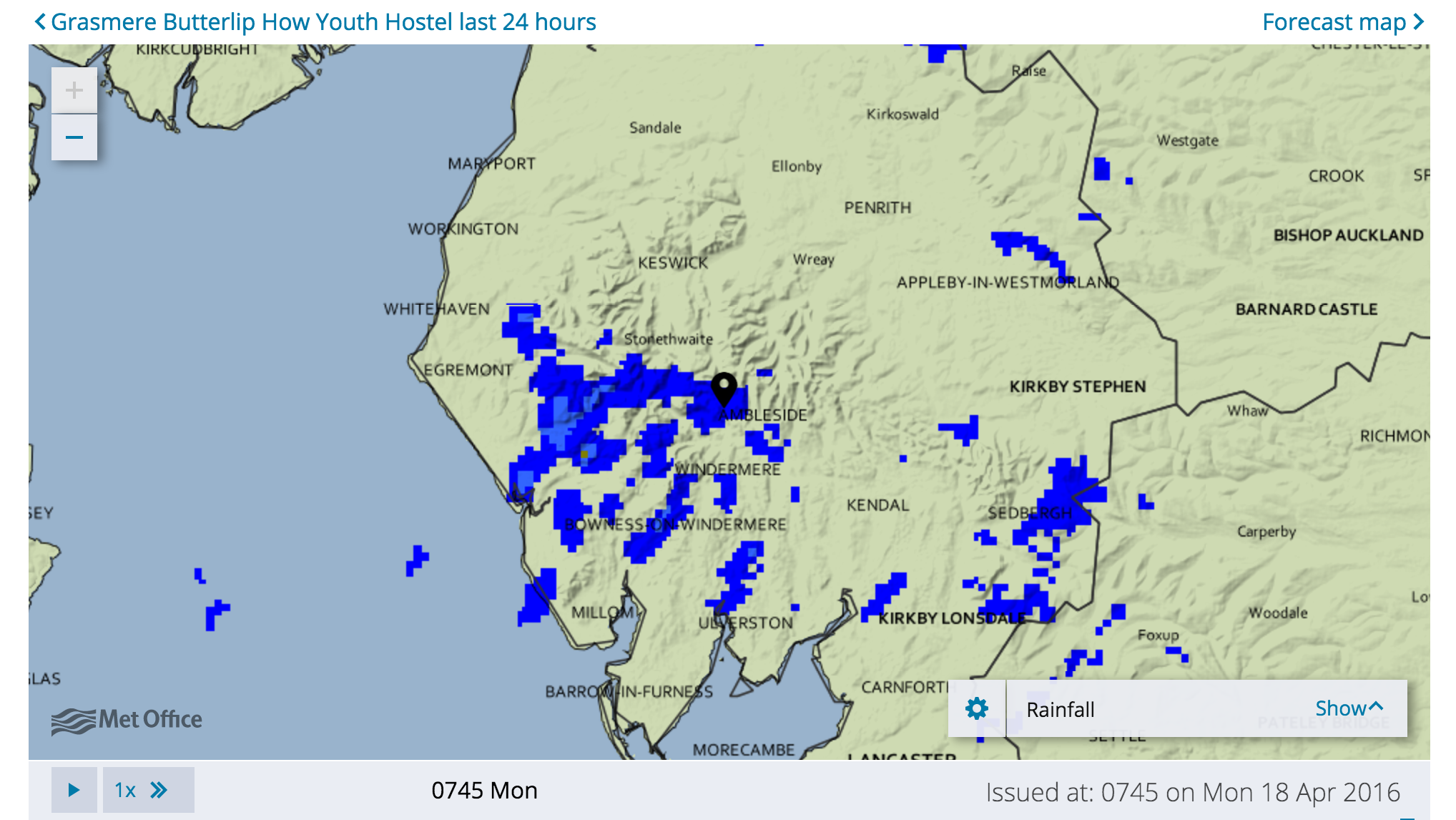
Now that we are within two weeks of the off it isn’t unreasonable to start looking at the Coast to Coast weather and the Met Office is the obvious place to go:

UK Outlook for Friday 22 Apr 2016 to Sunday 1 May 2016:

Friday sees rain in the south pushing north for a time, maybe reaching central parts before slowly clearing, though temperatures should be around normal. Further north a cold airflow is expected to become established, bringing showers or longer spells of rain, with snow over higher ground. Wintriness is also possible down to low levels in the far north, along with some gales. The cold conditions are expected to spread to all areas through next weekend and into the start of the following week, bringing periods of sunshine, showers and longer spells of rain, these turning wintry at times. The cold, unsettled conditions are then expected to persist through to the start of May, with rain or showers turning wintry over most parts and widespread overnight frosts.

I can attest to the snow over high ground as it very definitely snowed on me whilst camping in Derbyshire over the weekend. We were lucky with the daytime weather whist walking and had all the right kit anyway.

The next period is the important one:

UK Outlook for Monday 2 May 2016 to Monday 16 May 2016:

May is expected to start cold, with a northerly flow bringing sunshine and showers, with some of these turning occasionally wintry, especially in the north, along with widespread overnight frosts. As we move into the second week of the month, there is a slight signal for more settled conditions, with temperatures possibly moving towards average for the time of year.

Updated at: 1139 on Sun 17 Apr 2016

The first point is that it that our walk is indeed up north – so the “especially in the north” bit for wintry showers is relevant. There is a reason for mild optimism as we enter the second week of our walk with the “slight signal for more settled conditions” as long as it doesn’t mean snow is going to settle on the ground.

The old adage says there is no such thing as bad  weather, just bad preparation. This is only true up to a point. Even if you have all the right gear, walking into driving rain isn’t pleasant and is very definitely going to slow you down.

Now I’m not whinging here. OK if there is bad weather yes it might take us a little longer to do the day’s walk but the main issue will be whether we have to make diversions. Walking in the mountains when it is stormy is to be avoided.

Wainwright himself recommends lower alternative routes in such circumstances which would really just mean not getting to see some of the views. Might also mean avoiding some of the climbs which nobody is going to complain about.

This might be a problem on some of the days. For example the Rosthwaite to Patterdale leg is a killer involving 17.5 miles and two big climbs. People often break this into two days walk stopping overnight at Grasmere. This was not Wainwright’s choice but there again as a hardened walker he could probably easily cope!

The problem is that there isn’t a quick way round by road to avoid the mountain weather. Grasmere to Patterdale is 40 minutes in a car.

We will just have to play it by ear.

The only saving grace is that the British weather is notoriously changeable and who knows what it is really going to be like:)

Don’t forget I’m raising cash for Cancer Research UK whilst on this Coast to Coast walk. The JustGiving page is here. The start date of the walk coincides with the anniversary of my mother’s death on May 1st last year. Mam was Chairman of the Marown & District branch of the IoM Anti Cancer Association.

Categories
4g broadband charitable Coast to Coast End User

Coast to coast walk broadband coverage

Coast to Coast broadband

Thought it would be interesting to see what the Coast to Coast broadband coverage was likely to be during our walk in May. It will be most inconvenient is I cant upload stuff at the end of each day. I’m assuming that the daytime coverage in the mountains will be largely on existent which is a bit of a shame as otherwise I’d be able to store my pics and videos as I go along.

I used the BT postcode checker, EE’s own website for mobile coverage  and the Ofcom coverage page. The results are below.

The places with very little or no bandwidth are small villages. The larger the place the more likely they are to have service. Obvs.

If I left out the place names and postcodes you could guess which stopping points were in National Parks and which weren’t. Clearly the inhabitants of these places have compensations to offset their poor internet access (innit @Cyberdoyle? 🙂 )

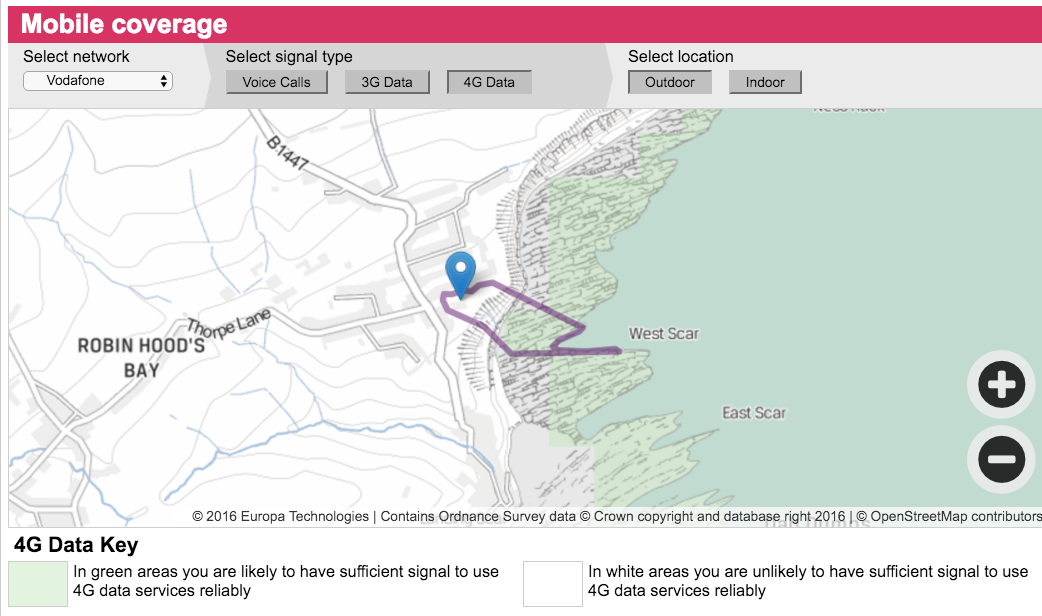
What I thought most amusing was that at our ultimate destination, Robin Hood’s Bay, the only network that apparently has 4G coverage is Vodafone and that is out at sea – see featured image. So if the tide is out people with Vodafone sims get good connectivity. Hopefully they have waterproof phones.

Day Place BT checker EE coverage Ofcom 4G checker
Saturday St Bees CA27 0DE 68Mbps 4G EE
Sunday Ennerdale Bridge CA23 3AR 1Mbps none EE nearby
Monday Seatoller CA12 5XQ 1Mbps none none
Tuesday Patterdale CA11 0PJ 80Mbps none none
Wednesday Shap CA10 3LX 33Mbps 4G EE good O2/Voda fair
Thursday Kirkby Stephen CA17 4QQ 78Mbs 4G EE
Friday Keld DL11 6LL 2Mbps none none
Saturday Reeth DL11 6SN 73Mbps 2G no data none
Sunday Richmond DL10 7AG 75Mbps 4G all good
Monday Ingleby Cross DL6 3LN 73Mbps 3G O2/Voda good EE sketchy
Tuesday Chop Gate (Clay Bank Top) TS9 7JF 10Mbps none none – all sketchy nearby
Wednesday Glaisedale YO21 2QL 10Mbps 3G Voda limited
Thursday Robin Hood’s Bay YO22 4RJ 46Mbps 3G Voda out at sea only!

Would have been better had I been able to represent this data graphically but I can’t so never mind.

Don’t forget I’m raising cash for Cancer Research UK whilst on this Coast to Coast walk JustGiving page here. The start date of the walk coincides with the anniversary of my mother’s death on May 1st last year. Mam was Chairman of the Marown & District branch of the IoM Anti Cancer Association.

Categories
charitable Coast to Coast travel

Coast to coast tracking and other Galaxy S7 Edge stuff

Coast to Coast tech update

This coast to coast tech update involves my new phone. Am liking the Samsung Galaxy S7 Edge more and more especially as I discover more features.

The double click on the home button when the screen is locked brings up the camera v quickly. This is very useful. The only issue I will have on the coast to coast, where i will probably want to take lots of photos and videos, will be that ideally these photos will be embedded in the Runkeeper route map and will therefore need to be taken from inside the app. I may be able to programme the phone to bring up runkeeper quickly – will investigate.

The one thing that will be tested today is the battery life. Out and about in London I am certain to use the phone more. Even if it is just more photos and videos (of me:)). At 9.56 I am down to 85% having been fully charged before I left home.

One of the features that compares very well with the Oneplus 2 is the sharing to Google Drive. I photograph all my receipts as I get them and upload to specific folders on Google Drive. On the Oneplus2 I had to specifically delete the photo name and replace it with something more useful (eg taxi£5). On the Edge the old text is already selected and all I have to do is type in the new name. These are small things but greatly enhance usability. I imagine this is down to the specific instance of Android being used but it might be Samsung related.

Certainly the Edge doesn’t feel as if it has so much bloatware as earlier Samsung Galaxy devices I have used. This was one of my main complaints about Samsung. Having said that I don’t really use Samsung’s own apps.

With regard to tech for the Coast to Coast walk I think I’ve decided to use Runkeeper for the tracking with embedded photos but with Fitbit and the OS Maps app as alternatives. I’ve tested the Fitbit a fair bit and the battery life seems to be roughly 8 hours in GPS mode so it might be ok. The OS app will give me far better on the ground resolution but they don’t yet have the real time online sharing feature. Runkeeper will allow me to share my data with the world so I will be providing a link each day to the online route tracker so that you can see where I am. They also have APIs into Facebook and Twitter for sharing the data.

It means I will have to become a premium member of both the Ordnance Survey and Runkeeper but I think it will be worth it.

We have to remember that one of the reasons for this walk is to raise cash for Cancer Research UK so if anyone has any thoughts about how to increase the publicity surrounding the event please feel free to share. We are talking about extended publicity over a 2 week period starting on Sunday May 1st. More coast to coast stuff here. Donate at our JustGiving Page

ITSPA council meeting this afternoon. Ciao bebes.

Stay tuned for another coast to coast tech update when I have it 🙂

Categories
charitable Coast to Coast Weekend

Coast to Coast sponsored walk accommodation update

Details of our coast to coast accommodation

Quite a number of people have asked about accompanying us for some of the Coast to Coast walk. I now have the details of our coast to coast accommodation for each night so if you are considering coming along you can contact the B&B directly to check for vacancies.

Saturday 30th April St Bees hours miles Stonehouse Farm, 133 Main St St Bees CA27 0DE
Sunday 1st May Ennerdale Bridge 7 14 Thorn Trees, Ennerdale Bridge, CA23 3AR
Monday 2nd Seatoller 7 14.5 The Glaramara Centre, Seatoller, Borrowdale CA12 5XQ,
Tuesday 3rd Patterdale 9 17.5 Grisedale Lodge, Grisedale Bridge, Patterdale CA11 0PJ
Wednesday 4th Shap 7 16 New Ing Lodge, Shap, CA10 3LX
Thursday 5th Kirkby Stephen 9 20 Fletcher House, Fletcher Hill Market Street, Kirkby Stephen CA17 4QQ
Friday 6th Keld 6 13 Keld Lodge Hotel, Keld DL11 6LL
Saturday 7th Reeth 5 11 The Manse, Reeth DL11 6SN
Sunday 8th Richmond 5 11 Willance House, 24 Frenchgate Richmond DL10 7AG
Monday 9th Ingleby Cross 9 23 Ingleside, Ingleby Arncliffe Northallerton DL6 3LN
Tuesday 10th Chop Gate (Clay Bank Top) 6 12.5 West Cote, Chop Gate TS9 7JF
Wednesday 11th Glaisedale 6 18.5 The Arncliffe Arms, 1 Glaisdale Terrace, Glaisdale, YO21 2QL
Thursday 12th Robin Hood’s Bay 8 19 Raven House, Victoria Terrace RHB YO22 4RJ

If you need distances between overnight stops you can check them out on this previous coast to coast post. Most days roughly average around 2 to 2.2 miles an hour – I’ve stuck the miles between stops and estimated time taken for people who might want to choose a leg based on time or distance. Some of them are toughies with lots of climbs and rough terrain.

If you do think you might want to come along please let me know.

All the coast to coast accommodation we are using get good reviews so I reckon we’ve done alright here. I’m particularly looking forward to Richmond which is a short day with lots of pubs at the end of it.We may of course not be interested in beer by then – body/temple etc. On the flipside the Richmond to Ingleby Cross day is a monster at 23 miles (unless you are in the commandos in which case it will be a stroll in the park) so beer may be off the menu the night before.

Donations are coming along nicely with this morning’s tally at £690. Remember the cause is Cancer Research UK in memory of my Mam who died one year ago to the start date of this walk and who was Chairman of Marown and District Branch of the IoM Anti Cancer Association. Dad thinks Cancer research is very well funded and that there are other equally deserving causes such as Alzheimers Disease. My view is that progress towards sorting cancer is coming along very well and the more we can throw at it at this moment the better.

JustGiving page is here.

Featured image courtesy of the Arncliffe Arms website. I’m sure they won’t mind.

Categories
Coast to Coast End User phones

Galaxy S7 Edge First Impressions

Galaxy S7 Edge waterproof phone

I need a waterproof phone for the Coast to Coast sponsored walk. The new Samsung Galaxy S7 Edge is a bit of a result. It feels great in the hand and the camera would appear to be top notch. I did um and ah a bit before buying it as it comes with a hefty price tag – £630 from EE including a PAYG starter SIM which I don’t need but that was the deal.

My previous two phones have been the Oneplus1 and Oneplus2. As value for money they have been great and both are still usable. Once I’ve had the Oneplus2 screen repaired that is – it’s biggest weakness appears to be it’s poor resistance to a bit of rain.

The Oneplus2 was also not the most reliable phone – kept locking up when using Runkeeper I needed it for taking photos. This is whilst I’ve been out on my Coast to Coast training walks. I’m hoping that in the Galaxy S7 Edge I have a phone that will do the job for me on the actual coast to Coast walk.

The Oneplus 2 is billed as a flagship killer. It isn’t. It is almost there but misses a few finesses. One has to remember it is less than half the price of the S7 Edge. Not being waterproof was a killer for me. Once repaired I’m going to use it as a backup and a second phone when travelling – the two SIM trays was very useful. I’d use my EE SIM for calls and texts and a local in country SIM for data. Roaming data charges are total ripoffs.

I suspect the battery capacity of the Edge is only just going to be ok. It is now 10am and the battery is at 65% charge. I charged it up yesterday evening and it lost maybe 10% just sat there overnight. This, I assume is down to the lock screen data which I guess I could disable. I’ll leave it as is for now. It isn’t a problem at the moment.

The fingerprint recognition works really well on the Samsung. It feels as if it is an improvement on the Oneplus.

I did look at the iPhone but tbh that was too big a jump for me. I am now the possessor of a high end Macbook Pro. Most of my pals in the networking industry use such a device. I now consider that I have the right laptop and phone. The chromebook can stay as a backup and will also probably be the laptop i take with me on the Coast to Coast – I don’t want to risk the Macbook Pro being nicked in transit between B&Bs. It does mean my video editing capabilities will be constrained for coast to coast blogging purposes but I can stick to one take videos which is what I do now.

One of the things that has amused me is the presence of Microsoft Office apps on the Edge. I abandoned Microsoft years ago now and won’t go back. The icons have been moved to a safe place. Ditto the Samsung Apps.

Don’t forget that in May I am doing the Wainwright Cast to Coast Sponsored walk in aid of Cancer research UK. This is in memory of my Mam Eileen who died one ear ago to the day of the start day of y Coast to Coast walk. She was an active fundraiser and Chairman of the Marown and District Branch of the IoM Anti Cancer Association. I am being accompanied on the walk by my son Tom and two friends Mark and Luke Agius. If you want to support the cause the please go to the JustGiving page. 

PS re the waterproof phone bit – I’m not going to test it – don’t want to push my luck 🙂

Categories
charitable Coast to Coast Weekend

Coast to coast training update

Coast to Coast training progress

The Coast to Coast sponsored walk is 27 days away so it’s time for an update on how the preparations are going.

Since I pushed the button in January and bought a pair of boots I’ve been gradually upping the level of intensity of the “training”. As well as my usual morning swim, which is a great calorie burner, I’ve been going on longer and longer walks.

These began as one hour three milers,  increasing to five miles (the first of which ended at the Strugglers Inn in Lincoln). If you have a sedentary lifestyle you feel even these relatively short walks – sore back during the walk, very sore feet after the walk & stiffness the next day.

The first longish walk was an eight miler from Lincoln out to Scothern and then on to Nettleham. It was a freezing day and much of the walk was into the teeth of a wind so I didn’t make it the last three miles back into Lincoln but caught a convenient bus instead. The stop at the cafe in Nettleham put paid to the resolve.

After that walk I started to put together longer trips and did 7 or 8 10+ milers including a walk from Lincoln to Wragby along the very busy A158. This is when I concluded that walking along the road wasn’t a good idea, especially when the A158 ran out of footpath two thirds of the way along. I now try to keep to proper off road footpaths.

Pretty much all of these local walks have been along the flat. They culminated with an 18 mile stroll with my son and partner in crime on the C2C Tom from Lincoln to Woodhall Spa along the side of the river Witham. This took a good 7 hours and was the first walk that was similar in length to some of the days on the Coast to Coast where the average is around 16 miles a day.

it was after the Woodhall walk that I unfortunately had to conclude that I needed different sized boots. My left foot is one size bigger than my right and this foot needed a boot a half size bigger. This is an expensive situation as I ended up buying two top of the range pairs of Meindl boots at sizes 9 1/2 and 10. I need to find a boot buddy with matching but reversed shoe size requirements.

I bit the bullet on the boots because they are the most important bit of kit for a walker.

The new “odd” sized boots have now been road tested in Snowdonia and Derbyshire where in the space of 8 days I did 5 walks including climbs of 1,200 feet or more. The Snowdon climb was 2,200 feet and was a killer for someone who isn’t fit enough. Snowdon itself is 3,500 feet but fortunately (strange perspective perhaps) the advice from the ranger was not to go beyond the snow line so I didn’t 🙂

This week has been great prep for the Coast to Coast where the climbs are typically 1,500 feet although one of the days in the Lake District will have two of those. I feel as if the task – 12 days and 192 miles is doable. Survivable.

The sore back seems to have gone and the feet are certainly a lot less achey after a walk than they had been at the start of the training.

I now have most of the gear that I need, purchased largely from GoOutoors in Lincoln. This shop has been a pleasant surprise as they have staff there who really seem to know what they are talking about and they are willing to price match anything you can find cheaper elsewhere and knock a further ten percent off. This was a result when I bought my Deuter day bag which was £110 reduced to £100 instore. I found it at Millets online for £77 so GoOutdoors sold it to me at £70. Result.

I also have merino wool base layers, various fleeces and a Marmot hard shell outer, Montane walking trousers which are seriously good and Berghaus overtrousers. I sweat buckets on a walk but this kit is perfect and dries very quickly.

The one aspect of the walk that isn’t totally sorted yet is the tech. I have been using Runkeeper on my Oneplus 2 to track progress and take photos en route. However I discovered in Snowdonia that the Oneplus 2 is very definitely not waterproof. In fact it is now knackered and either needs fixing or replacing.

I have been using a Fitbit Surge that was very kindly sent to me by Fitbit for the walk. I don’t normally wear a watch but will need one for the C2C to keep abreast of time/progress. The Surge is good but I’m not sure will have a good enough battery life to last the whole day when using GPS. I’m still testing this.

It may be that I stick with Runkeeper for the tracking as there is a plugin that allows you to post live progress updates on the blog. I’ll update you on this as I get nearrer the off.

The next few weeks are going to be mixed from a training perspective. I have a weekend mountain walking in Derbyshire planned but also a few business trips which are absolutely no good from fitness perspective. Most readers of this blog are in the internet industry and will understand the”social” problem associated with conference going.

I’m likely to concentrate on swimming and aerobic sessions in the gym. Nothing replaces walking as exercise but improving my lung capacity will stand me in good stead up the hills in the Lake District and takes less time. I have also shed 10Kg since January and if I can do the same again in April that will also be a benefit.

That’s all for now folks. Remember I am doing this Coast to Coast training in preparation for the sponsored walk in aid of Cancer research UK. I have a JustGiving page if anyone feels as if they want to donate to the cause.

Image is of Me, Irina Trentea, Will Hargrave and Andy Davidson atop Winhill last Saturday.

Stay tuned…


Video shot by Andy Davidson

Categories
charitable Coast to Coast End User Weekend

Coast to coast Sponsored Walk provisional schedule

coast to coast sponsored walk provisional schedule

The Wainwright coast to coast sponsored walk provisional schedule is provided below. This is the route as prescribed by Alfred Wainwright.

Saturday 30th April Travel to St Bees
Sunday 1st May Walk St Bees to Ennerdale Bridge 14 miles (22.5 km)
Monday 2nd May Walk Ennerdale Bridge to Rosthwaite 14.5 miles (23 km)
Tuesday 3rd May Walk Rosthwaite to Patterdale 17.5 miles (28 km)
Wednesday 4th May Walk Patterdale to Shap 16 miles (25.5 km)
Thursday 5th May Walk Shap to Kirkby Stephen 20 miles (32 km)
Friday 6th May Walk Kirkby Stephen to Keld 13 miles (21 km)
Saturday 7th May Walk Keld to Reeth 11 miles (17.5 km)
Sunday 8th May Walk Reeth to Richmond 11 miles (17.5 km)
Monday 9th May Walk Richmond to Ingleby Cross 23 miles (37 km)
Tuesday 10th May Walk Ingleby Cross to Clay Bank Top 12.5 miles (20 km)
Wednesday 11th May Walk Clay Bank Top to Glaisdale 18.5 miles (29.5 km)
Thursday 12th May Walk Glaisdale to Robin Hood’s Bay 19 miles (30.5 km)
Friday 13th May Depart from Robin Hood’s Bay after breakfast

We won’t have the exact details of the overnight stops until I’ve paid the final cash for the trip to the travel agent, Contours Walking Holidays (whose image we are using in this post). We are staying at B&Bs each night and our bags are being transported from location to location. There is no way I would manage carrying two weeks worth of kit.

Our friend Adie Smith’s son Tom did this and also camped every night. He completed the walk in 7 days or so and after the first day had to do it in flip flops because his feet blistered badly in his boots! I am not in that league.

When I get the final details of the B&Bs I will let you all know. Quite a number of people have already expressed an interest in joining us for part of the journey.

As a reminder my son Tom and I are doing this in memory of my Mam Eileen who died one year to the day we start the walk – May 1st. Mam did not die of cancer but was Chairman of the Marown and District branch of the IoM Anti Cancer Association. My father in law Keith died of the disease in 2014.

If you want more detail on the walk itself there is a wikipedia entry. I will also be keeping the trefor.net coast to coast sponsored walk event page updated as things happen.

Our JustGiving page is here.

Categories
charitable Coast to Coast End User Weekend

Preparation for the coast to coast sponsored walk

coast to coast walk preparation – no pain no gain – my feet hurt 🙂

You may have read yesterday about my intention to do the Wainwright Coast to coast Sponsored to raise cash for Cancer Research UK. I am doing this in memory of my mother Eileen who died on may the 1st 2015, exactly one year from the date we start the walk. Mam had been Chairman of the Marown and District Branch of the IoM Anti Cancer Association. My father in law Keith succumbed to cancer in 2014. This post is the first that discusses my coast to coast walk preparation.

The Wainwright Coast to Coast walk is rated as the second best walk world (I read somewhere) and is 190 miles from St Bees in Cumbria on the West Coast to Robin Hood’s Bay in Yorkshire on the East. The walk takes in the Lake District, The Yorkshire Dales and the North Yorks Moors. It is a pretty gruelling 12 days of walking and there is no way I would have been able to take it on in January when we decided to go for it with friend Ajax (Mark Agius) and his son Luke.

May 1st however seemed to be suitably long way away giving me plenty of time to prepare. You have to remember that my idea of exercise was to walk to the pub half a mile away and I may even have cadged a lift back off my wife.

I took it as a challenge to get fit enough to complete the walk. It seemed to me that not only would I be fit if I managed to survive 12 days non stop walking 9am until 5ish on most days but I had to be reasonably fit before even setting off.

I bought a pair of walking boots.

My feet are wide and odd sizes (right foot is an 8 and left foot is a 9). Finding a suitable pair of boots I thought would be a challenge. I tried a load on in a couple of shops but always felt that they were either too big for one foot or too small for the other.

In the end I drove to Richmond in Yorkshire to the Alt Berg factory shop where they were happy to pair you up with odd sizes. However they didn’t make their boots wide enough for my feet (!!!) so I ended up buying a pair of Meindl boots off the shelf.

I’ve spent the last few weeks going on occasional walks using the Meindl boots. My feet are still sore after every walk but I am hoping this will gradually diminish the more I walk. Thirty years of sitting with my feet up on a desk will take more than a few walks to sort out.

In the last two or three weeks I have completed 6 walks of between 9 and 10 miles. I now need to start stepping up the pace and increasing the distance. The longest day on the coast to coast is 23 miles so 10 miles doesn’t even get me half way.

At Easter the family are off to Llanberis for some walking in Snowdonia. I figure if I can put some hills in that will help me when it comes to the Lake District where some of the days involve more than one ascent. If I can climb Snowdon then i can take on anything the Lake District can throw at me.

Two out of the following three weekends I will be walking in the peak district (Andy and Suddy and then with the Scouts) and then that leaves me with two more weeks until the beginning of May. Not far off really!

Featured image is the route of today’s walk. Check out my coast to coast walk event page. Details of today’s coast to coast walk preparation are on my personal blog philosopherontap.com.

Categories
charitable Coast to Coast End User travel Weekend

Wainwright 190 mile Coast to Coast sponsored walk in aid of Cancer Research UK

Coast to coast sponsored walk

On May 1st 2016 my son Tom and I will be setting off from St Bees in Cumbria on the West Coast of England to walk to Robin Hood’s Bay on the East Coast. This is a 190 mile coast to coast sponsored walk.

coast to coast sponsored walk cancer research logoWe are doing it to raise funds for Cancer Research UK. There are two main reasons why this is important to us.

  1. May 1st is the first anniversary of the death of my mother, Eileen. Mam did not die of cancer but she had been Chairman of the Marown and District branch of the Isle of Man Anti-Cancer Association (where I grew up). Raising funds to help beat cancer was important to Mam. She was a nurse and had spent years helping and comforting patients at the end of their lives.
  2. My wife Anne’s father Keith died of Cancer two years ago.


So this walk is in memory of these two important people. I am expecting some side benefits. Walking for 190 miles across the lake district, Yorkshire Dales and the North Yorks Moors is going to be somewhat of a challenge for someone who has spent the last thirty years with his feet propped up on a desk. I have had to get into training just to be able to even get to the start. I’m hoping there will be less of me at the end than there was at the beginning of the odyssey.

The other benefit will be spending two weeks in the company of my first born effectively away from electronic screens. At this point I hear some of you fall off your chairs in disbelief. How can this be so? 🙂

Well the trip is not going to be entirely offline, other than the fact that there will be little or no mobile reception along much of the route. I am expecting to post updates from our B&B(/pub) every night and will be publishing a live tracker of our progress en route. Expect vids and pics.

Tom and I would also like to think that the walk will raise some serious cash for the cause. Most people have been touched by cancer in one way or another. In 2016 we are seeing signs that there is light at the end of the tunnel but we aren’t there yet.

If you would like to help please consider making a donation, no matter how small, to our JustGiving Page. Our chosen charity is Cancer Research UK.

Also if you want to come along on all or part of this walk then you are very welcome to do so and should get in touch.  Our friend Mark Agius and his son Luke are coming the whole way. We set off at 9am on Sunday 1st May and arrive at our destination at tea time on Thursday 12th.

Stay tuned to this blog for more info as it happens and in particular the coast to coast sponsored walk event page.

Featured image courtesy of Contours Walking Holidays.